Difference between revisions of "Vales of Hendowar"
m |
m |
||
| Line 7: | Line 7: | ||
'''None''' | '''None''' | ||
== Resource Mine Products == | == Resource Mine Products == | ||
| − | '''This zone has no | + | '''This zone has no resource mine''' |
== Microzone Listing == | == Microzone Listing == | ||
Revision as of 21:57, 20 January 2014
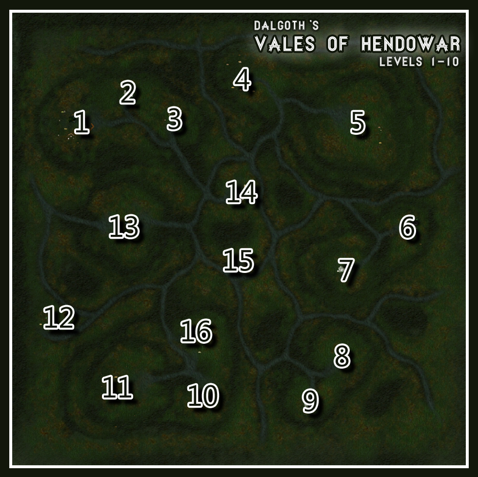
Vales of Hendowar is a forest-themed macrozone in Dalgoth.
Lore Description
Adventurer Level: 1 - 10
"Once populated by human settlers and farmers, this land has been overrun by savage Grobolds who left a trail of burnt farmhouses and homes in their wake. The caverns that dot these hills are filled with their feral relatives, the Batkin."
Discipline Runes
None
Resource Mine Products
This zone has no resource mine
Microzone Listing
- Farmhouse Ruins (113160 x 21350)
- Batling Lair A (113560 x 21560)
- Grobold Sentry Campsite (113900 x 21410)
- Grobold Guard Post A (114480 x 21750)
- Grobold Village (115430 x 21300)
- Grobold Shrine (115750 x 20600)
- Grobold Sentry Camp (115250 x 20260)
- Orc Slaver Campsite (115175 x 19560)
- Batling Lair B (114900 x 19250)
- Grobold Campfire (114170 x 19280)
- Burnt Farmhouse (113480 x 19333)
- Grobold Campsite A (113040 x 19870)
- Burned-Out Home (113626 x 20543)
- Grobold Guard Post B (114410 x 20870)
- Grobold Hunting Party (114380 x 20320)
- Grobold Campsite B (114060 x 19720)
